The second leg of my Ilocos trip took me from Laoag up to the the northernmost tip of the island of Luzon, stopping by the many interesting places in between. I had a different mindset about this leg. There is a strange and indescribable curiosity that one gets when going to a land’s end, as if one expects to find a pot of gold or the landscape dramatically changing. But I digress.
In all honesty, the entire landscape of Ilocos is quite different from what I am used to in Manila. There is a certain dryness in the land that accommodates what is probably the largest patch of “desert” in the Philippines, endless tobacco plantations as well as plenty of sun baked grass fields. This has translated to a landscape that is slightly different from the rest of the island and for this second leg of my Ilocos trip, I was able to visit some of these “quirks.”
From Laoag where we were based, it was a pleasant drive across a narrow but relatively traffic-free highway up north. We passed by many quaint towns in between and I couldn’t help but notice how there are just so many occasional odd mansions popping up among a larger group of more modest houses in each town we passed. I later learned that many Ilocanos actually migrated to the USA, most notably Hawaii, during the Marcos era to work overseas. The resulting “mansions” are the fruits of these migrants’ labor, where some have chosen to return while others had built the houses for their other family members who remained in the Philippines.
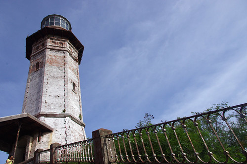
After a short drive, we arrived at the Bojeador Lighthouse. Built on a hill, the lighthouse actually dates back from the Spanish era and today still functions to warn approaching ships of the craggy Ilocos coastline. It is now a well-known tourist attraction. When I visited, there was not a shortage of souvenir stalls selling miniatures of the lighthouse as well as other iconic Ilocos landmarks. There is also a small museum inside which features the building’s history.
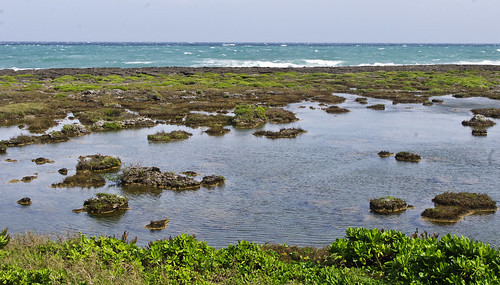

kapurpurawan rock formation
From here, it was a further 30 minute drive or so to Kapurpurawan, with its rock formations having been formed by what must be hundreds if not thousands of years of erosion plus constant interaction with the surrounding sea. It is a sight to behold especially during sunny days when its wavy beige contours seem to glow with the sunlight. At the time of our visit, there were still some leftover props from some filming done a few months before for a local movie. You’d think that they’d clear it by then but for some odd reason, the props were kept due to their similarity with the surrounding landscape.
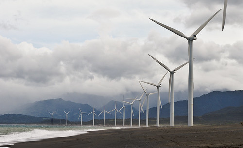
But perhaps the true highlight of this leg were the massive Bangui windmills which is situated near Pagudpud. The setting couldn’t have been better, with the sea in front and the mountains behind. These whitewashed giants seemed to extend for miles with the cool wind breezing through and enabling these power-generators to go round and round in a wonderfully relaxing pattern.
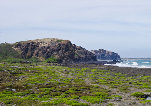
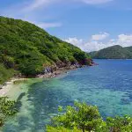
Then there is also of course Pagudpud itself which is situated nearby. Composed of several beaches including the blue lagoon and Saud beach, the area has often been cited as one of Luzon’s best. However, it was gray and drizzling by the time we reached there, not to mention freezing. I later learned that while December is usually considered as dry season in Laoag; Pagudpud, which faces Taiwan, is mainly wet. It was a real shame as the scenery in and around the blue lagoon was truly breathtaking.
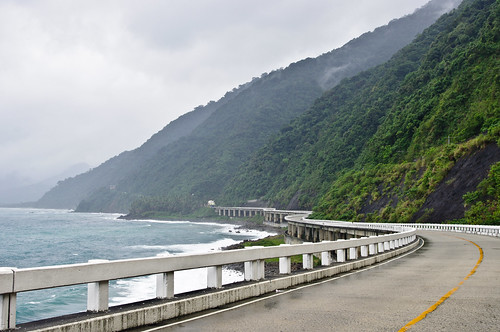
patapat viaduct
As a consolation, we were still able to stop by Patapat Viaduct. This was one of Marcos’ projects during his presidency and is considered one of the hallmarks of civil engineering in the Philippines. Perched along the side of a mountain range that falls directly into the sea, the viaduct winds its way through like a snake across the uneven and elevated land.
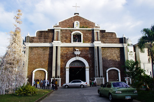
bacarra church
From here we made our way back to Laoag, but not before stopping by Bacarra for a short pitstop at its church with a leaning belfry.
And so that was the end of one productive day. We managed to reach the northernmost point of the island where I was born and reached our starting point by end of day. I was now really looking forward to the last leg of our trip which was to the UNESCO World Heritage town of Vigan.
This is a 3-part series detailing my trip around the Ilocos Region in December, 2012. Read the other posts here.
Leave a Reply